



































Oropa Pilgrimage in Four Days: Stages and Gear
Route, effort and preparation
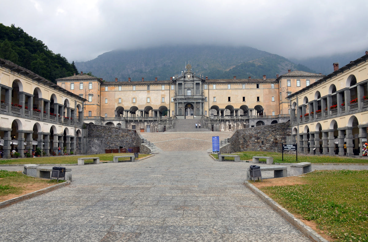
The Cammino di Oropa is a documented four-day trekking route that starts from the Stazione di Santhià and arrives at the Santuario di Oropa (Duration: 4 days; Place of departure: Stazione di Santhià; Place of arrival: Santuario di Oropa). The total reported positive elevation gain is about 1,000 m. Before you leave check three essential things: the weather for the exact dates of your trip, the current condition of the route and any official notices for the area. These day-of checks are decisive: never replace official bulletins and notices with generic guidance.
Where the route starts
Open the starting-point pin in Google Maps: Stazione di Santhià
Route map
The line follows the GPX track published by the cited source. Use it for orientation, but always check signs, conditions and notices before setting off.

We’ll send you links to this route’s official GPX track and its starting points.
Notify me when my size arrives
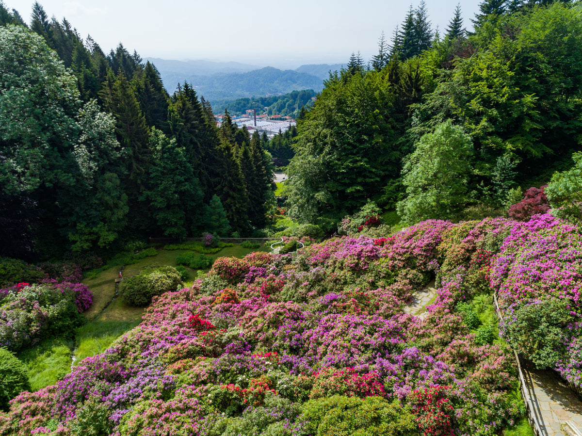
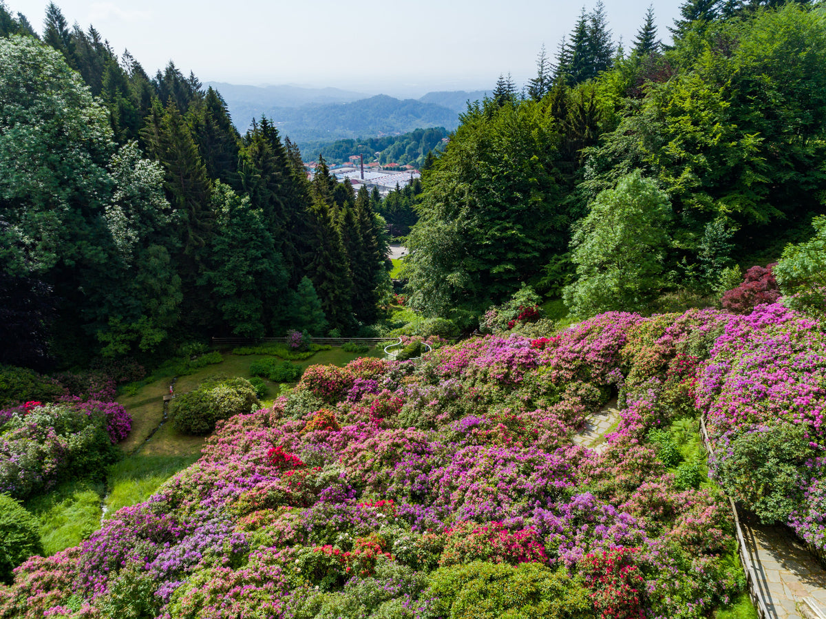
Views along the route


Itinerary and stages: the verified facts you use to plan
Official information describes the Cammino as four consecutive days. Among the documented sections is the Santhià–Roppolo segment, listed as 16.5 km with 230 m of ascent. The Cammino has dedicated waymarking: you will find yellow and black markers and yellow painted arrows along the route. For the final stretch there are practical references useful to break down the climb: from the rise from San Giuseppe to Cavallo superiore a gain of about 225 m is reported, estimated at about 2 hours; from Cavallo superiore to the Santuario di Oropa the reported elevation gain is about 525 m, with an indicative estimate of about 2 and a half hours. Use these figures as reference points to decide stage lengths, rest stops and expected effort levels.
What to check before you leave
- Consult the updated weather bulletin for the exact dates of the trip and plan alternative stages in case of deterioration.
- Verify trail conditions and the presence of waymarking: maintenance can vary and some sections may have temporary deviations.
- Check official day-of notices (local authorities, civil protection, land managers) for restrictions or alerts.
- Prepare an emergency plan: useful numbers, support points along the route and return options for each stage.
Season and intensity: how they affect clothing
Documents on the Cammino list possible conditions in all seasons: winter, spring, late spring/summer and autumn. This means you can encounter very different climates: cool temperatures in intermediate seasons and potentially hot weather in high summer, but with climbs that require prolonged effort even in mild temperatures. If you plan in spring or autumn expect cooler mornings; in summer consider sun protection and ventilation. In winter the variability of the terrain requires specific checks on current conditions.
Two ways to build the look
AI-generated outfit scenes grounded in the linked product photographs. The landscape is illustrative.


Products mentioned in this article


Layering: how to build clothing for 4 days
For a multi-day trek the rule is simple: garments that dry, compress and behave predictably. Here are practical choices and explanations of the trade-offs.
Base layer
For the next-to-skin shirt favor fabrics that regulate temperature and odors: the T-shirt S/S Ocean Uomo Blu is described as 100% Merino wool, suitable as a breathable base with natural odor control. Bring at least one shirt for the day and a spare for the evening or for wetter days; merino wool reduces the feeling of damp cold while keeping comfort even during prolonged effort.
Products mentioned in this article

Pants and fit
Choose pants that allow freedom of movement but protect from brambles and wind: the Pantaloni Trail Uomo Neri are described as engineered for mobility and moisture management. An athletic fit with easy knee articulation works well on steep climbs and uneven sections. If you expect variable days, also bring a lightweight technical tight for cold mornings.
Mid layer and insulation
A compressible mid layer is useful for breaks and cold days: the Gilet Inversion Primaloft Uomo Blu is described with Primaloft insulation and moisture management, a practical solution when you want torso protection without overheating while walking. Choose a piece that fits easily in the pack and does not limit arm mobility.
Outer jacket
For the outer layer favor a piece that offers wind and rain protection while remaining breathable. The Giacca Atom Lightweight Hoody Donna Bliss/Spark is described with Coreloft™ insulation, Tyono™ 20 fabric and a DWR finish: it’s an example of the construction needed to keep you warm without weighing down the pack. If you expect prolonged rain, add a dedicated waterproof shell.
Accessories
A small multifunctional neck warmer is practical: the Scaldacollo Polar Cap Bianco is described as convertible into a hat, lightweight and compact. Also bring a brimmed hat, sunglasses and lightweight gloves; in cold season gloves should be thermal but compressible. Don’t confuse detail with weight: every gram counts on multi-day routes.
Footwear, pack and load management
Shoes must suit the surfaces you’ll encounter: look for a sole with good grip, toe protection and lateral support. If the route includes paved sections at start or finish, a trail shoe with a robust upper is often the best compromise. For the staged Cammino, if you sleep in hostels and don’t carry a tent, a daypack is generally adequate: it allows you to carry spare clothes, insulation, a waterproof jacket and daily provisions without excess weight. Organize the load so jacket and water are within reach; place heavy items close to the spine and high for stability.
Pace, breaks and fatigue management
The elevation and time references for the final segments (225 m ≈ 2 hours; 525 m ≈ 2.5 hours) serve to plan pauses and resupplies, but your pace will depend on fitness, load and route conditions. Break climbs with regular short rests during the day to recover without cooling down. Hydrate consistently and maintain regular intake of high-energy snacks.
Behavior on the trail
Respect the Cammino’s dedicated waymarking (yellow and black markers; yellow painted arrows), don’t create unnecessary variants and limit environmental impact: take your waste with you and keep quiet when approaching settlements or sensitive areas. If you need to change the day plan always choose waymarked routes and official support points so as not to complicate potential return operations.
Where to look for garments and the next step
If you want to see garments consistent with this approach you can explore the collezione Trekking to find alternatives and sizes. If you have doubts about fit or sizing, request a try-on or technical advice: measurements and fabric behavior in real use matter more than paper specs.
Good planning: schedule the four stages with margin for weather changes, check day-of conditions and listen to your body’s pace.
FAQ
How long is the Cammino di Oropa?
Official documents describe the Cammino di Oropa as a route lasting 4 days.
Where does the Cammino start and end?
The indicated departure is Stazione di Santhià and the arrival is Santuario di Oropa.
How are the trails marked along the Cammino?
The route is marked with yellow and black waymarks and with yellow painted arrows dedicated to the Cammino di Oropa.
What are the useful references for the second part of the climb to Oropa?
Documents report that the climb from San Giuseppe to Cavallo superiore has an elevation gain of about 225 m (approximately 2 hours); from Cavallo superiore to the Santuario about 525 m of elevation gain are indicated (about 2.5 hours).
In which seasons is the Cammino scheduled?
Official materials mention the possible seasons: winter, spring, late spring/summer and autumn. Still verify updated conditions for the chosen period.
Ski Sises on Google
Choose Ski Sises as a preferred source: you'll see our guides and news more often in Top stories on Google.